Sunday, 30 August 2015

Valley of Flowers and Hemkund -a Trek to Paradise

The Valley of Flowers
  
Climbing the last kilometer is strenuous, I sweat despite the mild cold, the thin drizzle permeates my clothing with dampness and the wet mud is slippery.  As I round a bend in the mountain side rapt in my misery, almost theatrically a wide vista unfolds showing a wide lush green valley with patches of colour and Mount Rataban proudly at its head.  It is magical, the tiredness of the climb falls away and the spellbinding view makes the arduous climb of two hours so very worthwhile. 


Angelica with cloud veiled mountains in the background

My trek to the Valley of Flowers (VoF) has been a dream for many years, a dream that I was determined to turn to reality for a week in August 2015.  There are many travelogues of ‘how to and where to’ on a trek to VoF so it is not my intention to replicate these. I will put together a kaleidoscope of thoughts and suggestions giving more of a flavor than a guide.
The trip started on Day One on a flight from Mumbai via Delhi to Dehradun and then a taxi to Rishikesh.  At Rishikesh I stayed at the Garhwal  Mandal Vikas Nigam (GMVN) guest house at Bharat Bhoomi, it is basic but neat, spacious and clean with very friendly staff. That evening I scoured the market for ways to get to Govindghat, I went to two taxi stands and a bus stand.  The taxi stands were misleading (and I suspect self servingly dishonest).  Quite by accident I discovered two important aspects, one that all visitors to Ghangaria were required to do a photo-registration at a booth near the bus stand, which I did.  The second was that there are direct taxis from near the Gurudwara at Rishikesh to Govindghat, I booked myself on one starting at 5 am next morning (Rs 500 a seat).  These are shared Tata Sumo with 10 passengers to a taxi which is a seriously tight squeeze, so I purchased an extra seat to make space for myself. 

On Day Two our taxi started at 5 am and it was a long, hot, dusty ride along rough roads with few halts, reaching Govindghat at 2.40 pm. Along the way passing through tiny towns which read like the index of a book by the redoubtable Jim Corbett who had shot some of his many man-eaters here,   Devprayag, Rudraprayag and Chamoli went by.  All along we followed the Alaknanda River till Govindghat.  This long taxi journey is perhaps the only tedious part of an otherwise lovely trip. A few kilometers short of Govindghat most network signals cease.

At Govindghat I cast around and found a nice hotel, Bhagat, and prepared for the trek next day. Repacking my day pack for trekking as opposed to travel by air and road, for a guideline of what I carry when I trek, please see my blog here:

Madan, my intrepid porter
 and I on the way up
The track going from Govindghat
 to Ghangaria
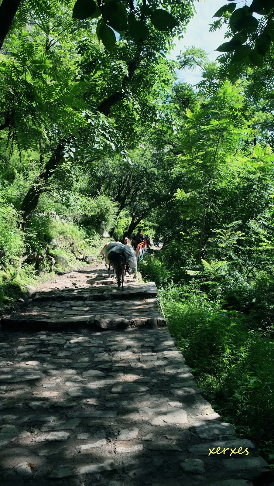
Up early on Day Three, my hotel manager hired a porter for me (Rs 790), he would carry my large pack to Ghangaria.  The porter and I walked about 1.5 km down to a bridge on the Lakshman Ganga from where a taxi would take us four km to the start of the trek. I started trekking at 8.20 am along a broad stone path which is undulating in its initial stages till the river bed. Earlier floods had washed away many bridges so the path went across causeways and stony river beds.  Being the monsoon, there are beautiful waterfalls on the opposite hillside, including a mighty three stage fall of at least 2 to 300 metres .  The path is largely well defined, shady and the walk pleasant. 

The route has many dhabas and I enjoyed the stuffed paratha and lemon tea, the latter being a very refreshing drink while trekking. After crossing the river, the climb is nearly continuous for about two hours till Ghangaria. There are many people on the route, Sikh pilgrims and tourists giving the place a carnival air. I trekked about 12 km, climbing from about 1800 meters to 3100 meters, reaching at about 2.30 pm.
A la carte - the menu at a decrepit dhaba
At Ghangaria, again it was hotel hunting time and after much looking around I settled for the slightly ‘up market’ Nand Lokpal. It wasn’t exactly five star, but moderately clean and comfortable.  Ghangaria has a very short season of about four months and everything is brought up by mule or porter hence food, water and commodities are expensive, so carry up what you can or be prepared to buy it at the prevailing rates.  An NGO called EDC is doing sterling work in managing waste in that fragile environment, it is vital that we add our mite to keeping the waste under control.
another waterfall along the route

At 3100m one has entered high altitude and it is important to take sensible precautions in acclimatizing for trekking higher to VoF and Hemkund.  Remember that Acute Mountain Sickness (AMS) can kill you or ruin an otherwise lovely trip; on the other hand a few sensible precautions can mitigate the risk considerably.  Before starting, have a doctor check you thoroughly to ensure that you are fit enough to undertake such a trek. Then follow an exercise programme a few weeks prior to make sure you are moderately fit to walk and climb at high altitude (there are many programmes on the net).


I did not buy water; instead I used water sterlising tablets the evening before to prepare two litres of water for each day’s trek. I do this whenever I am outdoors as it ensures I don’t have to buy plastic bottled water and so reduce the garbage in ecologically fragile areas.


Panacea for sore muscles
at the end of each day
Day Four saw me make an early start; I was out by 6 am and after a brief climb reached the forestchowky by 6.30 am to buy my VoF pass, (Rs 150 for 3 days). It was a bright and sunny morning and so that day there were many visitors and the trail up was a carnival.  The climb was ardous, but rounding a final bend the panorama is more than a reward for the ardour of the preceding two hours. I was at Shepherd’s Rock, a landmark in VoF, by 8.45 am and ate my packed breakfast (greasy sabzi- puri).  


Here I saw a jarring sign of the “great Indian tourist", the forest department had diverted  a mountain stream so that trekkers could fill water bottles. Right next to this someone had left a big, bright blue bar of washing soap, slowly dissolving into the pristine stream. A little further on I saw the shine of silver foil discarded after someone’s breakfast, lying among the flowers. I also met the guide/owner of a very large agency specializing in VoF; he boasted of his 400 GB of photos and his undying love of the Valley, all the while playing loud music on his phone!  We are somehow hell-bent on destroying our environmental heritage.


A list of some of the flowers
 to be seen at VoF

The VoF is truly spectacular, cloud veiled mountains stand sentinel around a green and lush valley through which the Pushpavati River flows, this valley in turn is dissected laterally by glacier fed mountain streams; all making for an idyllic scene. There is a stony path made by the forest department which meanders through the vegetation and one gets to see the flowers along this path. One path goes on to Joan Margaret Legge’s Memorial; she was an early pioneer into the Valley and the other path to the end of the Valley.


Joan Margaret Legge's Memorial

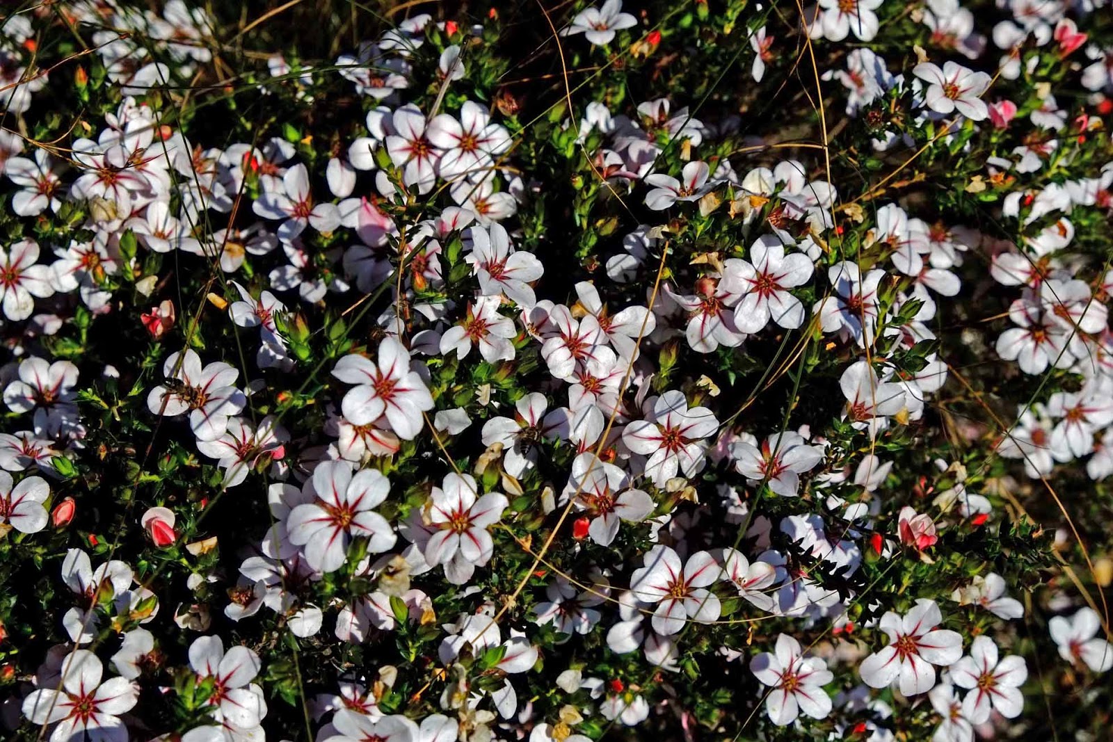
The flowers are spectacular, but I am no authority on flora and much has been written about the flowers in VoF, so I shall not dare tread there.  The common plants I saw were Balsam, Angelica, Bladderwort and Large Bellflower among stands of other beautiful flowers.  For my pictures please see these links to Flickr:

As is normally the pattern in the mountains, the weather rolled in at about 12.30 pm, clouds roiled up the Valley, wreathing the mountain slopes in white.  Shortly it began to rain, almost signaling me to begin my return journey which took about two hours in very slippery slush. I was back in Ghangaria by 4 pm.


Glacier and stream emanating from it in Vof

Ghangaria is a small town, and most mobile call services do not work here, there is no data service at all, so forget Whatsapp and e-mail. STD booths (I had almost forgotten these!) abound and I got a scratchy connection most evenings.  That evening I had a wholesome meal of rice, dal and chapatti in the langar at the Gurudwara. An interesting interlude was that every night a Himalayan black bear with two cubs would come looking for garbage behind the hotels or langar, some people saw them, but I didn’t!

On Day Five I went to the Hemkund Sahib Gurudwara, this is at an altitude of about 4400 meters and I did not feel acclimatised enough to trek up, so I hired a mule (Rs 1150 for the return trip). The trek up can be anything upto 4 – 5 hours, but the mule got me up in about two and a half hours.  I started at 6 am and was up by 8.30 am.  There was a silver lining to to reaching early; I reached before the clouds descended at about 10 am, giving me ample light to get in some spectacular photographs. The mule driver stops at the mid-way point to give the mules a breather and here I grabbed a paratha and lemon tea for breakfast.


The Sarovar at Hemkund  - simply breath-taking

No description or photographs do justice to Hemkund SahibSarovar, it is breath-takingly beautiful. The Gurudwara is a modern structure (Not very appealing, I prefer the old traditional architecture of Gurudwaras though), however when I went in to mathaa teko (pay obeisance) there was a group of Raagi’s  singing followed by the reading of the  paath.  It was a beautifully calm and serene moment which I sat down to absorb.  Next to the Gurudwara is a very old Lakshman Mandir, not as imposing as the Gurudwara, but the panditji had a wonderful charm and it was another very lovely moment. 


The Lakshman mandir


The Gurudwara

The Sarovar (lake) is truly awe-inspiring, very cold, calm and with the mountains around mirrored in the still water it is a sight to behold. The water is so cold that I could not put my hand in for more than a few seconds without excruciating pain, and here I saw the absolute tolerance faith inspires, an elderly Sikh pilgrim was having an unhurried bath in this icy water! 
Emerging from a bath in the icy water

After enjoying the lake, I trekked up the hillside behind the Gurudwara to see the famed and rare Brahma Kamal flower which was in full bloom. 


The famed Brahma Kamal
I had khichdi and tea for lunch at the Gurudwara langar, and then began my mule odyssey down again. A word about riding a mule at these altitudes, the path is narrow and the mule goes so close to the edge that its head is out over the abyss.  This is very scary at first, more so when descending when the mule does a little hop down every step.  It is important to lean forward a bit when going up and lean back with legs straight when descending, this gives the mule balance.  These are very sure footed animals and there is nothing to fear, sit loose and the mule will take care of everything.  I was down by 1.30 pm.

That afternoon I joined a birder group walking down about a kilometer towards the helipad where we saw a mixed hunting party of birds.  My sightings on the trip included Himalayan Vulture, Large-billed Crow, Oriental Turtle Dove,Wedge-tailed Green Pigeon, Coal Tit, Black Bulbul, Grey-bellied Tesia, Variegated Laughingthrush, Whiskered Yuhina, White-cheeked Nuthatch, Bar-tailed Treecreeper, Blue Whistling Thrush, Grey-headed Canary Flycatcher, Grey Wagtail, Pink-browed Rosefinch (very common), White-winged Grosbeak and Bar-throated Siva.


The lush, green Valley
On Day Six I went again to the VoF, after reading many articles and blogs, I had always wanted to go the the end of the Valley. I made a very early morning start at 6 am in pouring rain but when I was on top by 8 am the rain had miraculously cleared, after a brief stop for breakfast at Shepherd’s Rock, I moved on. Being the first up in the Valley I was rewarded by the sight of a family of Pika playing in a rocky nullah. 
The path to the end of the Valley

As I had vowed not take my camera out till I reached the end of the Valley so as to save time, I managed a couple of pictures on my phone.  After walking about four kilometers, the trail tapered off and ended at a river with no visible crossing point.  A quick reconnaissance showed an old path across, so I moved on another 3 km along this path, but I could not see the end, so at 1 pm I reluctantly turned back, exiting the VoF park at 5 pm.


The path from Ghangaria to Govindghat

Day Seven was the day when all good things came to an end, the day of my descent to Govindghat. I had planned to spend the night at Govindghat hence made a late start at 8 am. The same porter I had on the way up came and took my heavier pack as I was trekking with a daypack. It was a pleasant five hour walk down to the taxi stand where I learnt that a landslide had isolated Govindghat from the direction of Joshimath. It was important for me to cross that slide as I had onward reservations from Rishikesh. So, along with a couple of others similarly stranded, I walked another six kilometers to a taxi on the other side of the slide driving as far as Chamoli. The next day it was back to Rishikesh, Delhi and regrettably home.


Memories of Paradise

Tuesday, 25 August 2015

The Fashionate Trekker


While trekking to the Valley of Flowers a few weeks ago, I met a mountain guide and we got chatting about matters outdoors.  When I commented on a trekker in his group, ill-equipped and ill-shod, slipping in the wet mud, his reply was so apt “trekking was earlier a passion, but now it has become a fashion”.  Here is my advice to the ‘fashionate’ trekker.
It is great to see many youngsters taking to the great outdoors, most of them truly enjoying nature and the ‘get-away-from-it-all’ feeling that a trek to a remote area offers. However there are many who are there just to say ‘been there, done that”, they waft through the experience, shrouded in their social cocoons, immune to the joys of smelling the roses on the way.


It is this category of trekker who is careless of the environment, who with a mindless flick will throw an empty bottle by the way, who will leave the detritus of his lunch amidst the flowers, who will trample over delicate terrain to take a selfie, who will play loud music over his cellphone. Mercifully, the numbers of this type of trekker is inversely proportional to the difficulty   in getting there. Hence places like easily reached Bharatpur abound in them (see my blog http://xerxespa.blogspot.in/2015/07/bharatpur-keladeo-national-park-tail-of.html) whereas the hordes reduce as the degree of difficulty increases, (treks to the VoF and Great Himalayan National Park separate the wheat from the chaff). In VoF I encountered a tour owner (partner?) who gave me a long discourse on the joys of nature and the wonderful photographs that he has taken in all seasons (all 400GB of them), all the while playing loud indi-pop music on his phone! May the planet be saved from the ravages of such a trekker or guide.


Then there is the trekker who knows not, and this is a very forgivable category.  He wants to go there, he wants to learn, and he is willing to try but has not been guided correctly. He is ill-equipped, wears the wrong shoes and is unprepared for most eventualities.  It is for him that I write this blog, a guideline on the planning and preparation for a hike or trek. Essentially there are two aspects of a trek: physical preparation and correct equipment.  I will briefly give pointers to both.

Physical fitness is vital if you want to go off the beaten track, to remote areas, hike for several days and live rough; you have to be in good physical condition to enjoy the experience. It is when you are physically in control that you truly enjoy the trek without having nagging aches and pains to distract you. There are many sites on the net that explain how to build up to optimal physical fitness prior to a hike, adopt any one and go for it. I cannot emphasise enough the importance of being physically fit.
Read up and be aware of the physical conditions of the area in which you intend to trek, carry suitable clothing and equipment for those conditions. Know how to deal with extreme cold or heat and how to minimize the effect on your body.

Guard very diligently against blisters on your feet, they can seriously cripple you. Learn how to avoid blisters and how to treat them before they become crippling. Good socks and well fitting shoes are the single most important prevention measure for blisters.
The next most important aspect is gear. Good (and not necessarily expensive) gear makes a trek so much easier. A friend of mine Aarish, does a great line of gear at his shop, Dreams, in Kodaicanal.  He is very knowledgeable on gear and will guide you well. Email him at: aarishsingh@gmail.com

Keep in mind the following tips on gear and packing:
  • ·         Buy the best you can afford, particularly if you plan a lot of outdoor activity.
  • ·         Buy the lightest and least for your needs, every gram is going to seem to weigh a lot more once you start walking.
  • ·         Be prepared for the worst anticipated weather.
  • ·         Contrary to common perception, wear clothes made of modern synthetics which dry quickly or wool, both retain insulation when wet. On the other hand cotton is the least versatile as it dries very slowly and loses insulation when wet with rain or sweat. There are many quick dry soft synthetics available in sports stores, go for them.
  • ·         In your pack you must have at all times a spare set of socks and T-shirt, there is nothing worse for blisters than wet socks.  Whereas a wet T-shirt can quickly lead to hypothermia if the weather is cold.
  • ·         Carry the least number of rechargeable electronic devices you can, this becomes important in remote locations away from power sources. Carry spare batteries instead.
  •      The single most important gear is good quality and appropriate trekking shoes.  These are expensive, but if you are a regular outdoor enthusiast, there is no better investment.  Make sure they fit well, are worn in before a long trek and are preferably water resistant.


The second most important piece of equipment is a good rucksack/daypack.  Do not be over-ambitious in size, bigger is not necessarily better.  As the climb gets steeper, every extra gram is going to hang heavy. Learn how to wear a pack correctly; the weight must be on your hips and not your shoulders, this simple tip can change the way you trek.  Do not carry laptop bags slung low under any circumstances.


Other important equipment in no particular order is:
  • ·         Water bottles and water-purification tablets.  I have personal experience when I tell you that no matter how clear a mountain stream looks, someone is surely defecating or urinating into it upstream.
  • ·         Good rain wear is vital; it should be light and packable. A poncho in my opinion is better than a rain coat as it allows air circulation and protects other equipment.
  • ·         A personal pocket kit on your person is a life saver, literally.  Better to make your own than buy it as it will contain better quality items more suited to your needs. To make one see my blog here:http://xerxespa.blogspot.in/2014/11/personal-pocket-kit.html
  • ·         Carry a first aid kit appropriate to the activity you are going to engage in, the net offers great guidance on a suitable kit. Since I am not a paramedic, I carry common medicines for a headache, loose motions, allergy, muscle pain, anti-infection cream and band-aids.
  • ·         A good torch with spare batteries must be on your list.  LED torches last much longer on one set of batteries.


Fitness and the right gear make for a very pleasant trek, allowing you to be in the moment rather than worrying about the blister developing on your feet. So what makes it worth it? As at the end of a long and  tiring trek, you round the bend and before you the magic of the mountains unfold in a panorama that immediately wipes your tiredness away. And an old mountaineers blessing: “ May your trails be crooked, winding, lonesome, dangerous, leading to the most amazing view”.


Thursday, 23 July 2015

Bharatpur Keladeo National Park – A Tail of Birds?


Tranquility
Swirling fog, reflections of bare trees in the water, the cry of birds in the distance, placid Nilgai and Chital feeding in the swamp, a lonely Indian Rock Python by the side of the road; all haunting images of a beautiful bird sanctuary. This placid and almost utopian image was shattered by gunfire in the past and today by loud music, groups of people drowning out the jabber of jungle babblers with human cacophony; the careless flick of a tourist wrist throwing a plastic wrapper destined to choke an unwary bird to a very unpleasant death.  Jungle Babblers and Indian Magpie beg the passerby for a morsel, having lost the art of foraging as they've grown used to eating 'fast food' thrown at them by visitors. On a holiday it is obvious that most people come here to see and do everything except watch the birds or enjoy the placidity of nature. I saw couples and groups, most here just for the sake of being here, "Bharatpur dekha". 


Jungle Babbler begging tourists for food
Very few were intent on watching the birds or respecting the serene calm of the environment, most were rapt in their own social cocoons with a couldn’t care attitude to all else.  Humankind’s irrevocable carelessness to nature has been commonplace at Bharatpur ever since birds found it a convenient place to stop and recoup on their migrations. 

As Hubert Reeves put it:
"Man is the most insane species. He worships an invisible God and slaughters a visible Nature....
Without realising that this visible Nature he slaughters is the invisible God he worships."

A pair of Sarus Cranes and a Nilgai in the background
The slaughter began in the days of the maharajas and 'burra white sahibs', the tally of death being graven in stone beginning December 1902. Stone plaques proudly list the slaughter, in thousands. Battalions of men and women, decked out in sola topees and coiffed hair, carrying bespoke guns, descended on the unsuspecting birds and slaughtered them for sport. There were British royalty, maharajas, viceroys, generals and colonels, and sometimes just the plain old 'Mr'. Each of these was a 'gun' in a shooting party which blasted away at anything that flew, the unfortunate bedraggled bundle of dead feathers being the 'bag'. The magnitude of this slaughter decimated the bird population by the thousands. Apart from the bloodletting, the birds fearing danger, would have started avoiding the area in their migratory path.  This resulted in a drastic reduction of bird population and the possible avoidance by the migratory birds of an area bristling with guns.  This had an effect, the stone tablets showing the bag in the Park generally indicate an increase in guns and reduction in the birds killed as the years passed. 
One of the stone plaques giving a tally of  the massacre
 However, in 1936 the apparently intrepid Lord Linlithgow, Viceroy of India, with a party of 39 guns bagged 4273 birds on one occasion and about 5500 birds on three other shoots. Ten thousand birds in a few months, what could they have done with so much dead flesh? Eaten a morsel, fed some to the 'native' staff, and finally fed the dogs the rest?  What sport, a true sign of macho manhood indeed!  One needs to read old accounts of such hunts to understand the hardships that the hunters faced in their warm hides with multi-course breakfasts; shooting the unwary bird between sips of premium tea. Most Maharajas curried favour with the British bureaucracy by enabling grand hunts in their kingdoms, the greater the slaughter the higher the esteem in which the Maharaja was held.  Jolly good show, what?

purple heron taking to the air
The almost active attempt to reduce bird migrations has continued since, despite the Keoladeo National Park (KNP) being declared a Ramsar site due for the protection that this convention affords.  Chronic water shortages have further reduced the size of the wetlands so essential for migratory birds; the dry politics of water have kept birds away.  When I visited the Park in 2007 it was a dry wasteland, with a few bore wells desultorily pumping water into the parched earth.  I saw a large population of feral cattle vying with the wildlife of the Park for the scarce water and feed.  Again in 2015, I went there and was disappointed with the number and type of bird sightings, most of the big birds, cranes and storks, were conspicuous by their absence.


The king and his courtiers.... a Great Egret, Ibis
and whistling teal
 The permitted modes of movement in the park are on foot, bicycle and cycle-rickshaw.  The cycle-rickshaw peddlers most often double as guides with long and detailed lore of the park. My guide had peddled a rickshaw in the Park for about 20 years and his earnings over a six month season was his only livelihood as was that of most of the other peddlers. He said he is nervous about his own survival which is linked to survival of the park. He told me that the water being pumped in was being filtered so as to prevent the pumps from clogging and this filtration process removed natural food from the water and so was not attracting birds any more. There was a time, till recently, when these birds used to regularly nest here, they do so only sporadically now.

A crested serpent eagle surveys his domain
And of course the great Indian Tourist finishes off what little the Maharajas and water politics have left us. Large groups come to see KNP, they do just that, enter the Park, yell and shout, feed the birds with a lot of unhealthy fried foods, spray plastic wrappers and bottles everywhere and leave.  Ramsar? Conservation? Ecology?  What's that and anyway who cares, we are having great fun. Rickshaw peddlers, who depend on the park for a livelihood, try unsuccessfully to quell the noise and litter. These rickshaw peddlers are truly the conscience of the Park, when they are gone, all will be lost. I saw two adult visitors having a whistling contest at the waters edge!
an Indian Rock Python

If we continue on this trajectory, in a few years there will be no birds worth seeing. We have the scope and time to turn this around but draconian measures are called for if we are not to lose this site.  As I walk out of the Park along a plastic wrapper and bottle strewn path I wonder if this will be my last trip here. It is still not too late to save the tranquil stillness, the cry of a bird in the distance, a flurry of wings, and to worship nature in one of the few temples we have left.


Wednesday, 21 January 2015

Reis Magos Fort – Gunsmoke, Ghosts and Mario Miranda


Guarding the sea approach
A cannon and the turret typical to this fort on the
upper ramparts


Forts...... Evoke visions of battles, gun smoke, chivalry, heroism and even a touch of romance. India is replete with forts from time immemorial, everyone made them, ancient civilisations, the later invader turned rulers, and finally the European colonising powers. The industrial revolution really put an end to forts and fortifications as a pivot from which to wage war. A classic case being during the Second World War when the Germans outflanked the French fortified Maginot Line, arguably the last ‘fort’ constructed.
Silent Sentinel
A cannon with Portuguese coat-of-arms
guards the approach to the Mandovi

A fort was the symbol of power and writ and they were made for many reasons. These were primarily defensive (most Mughal, Rajput and Maratha forts), but often as the bastion of a city state (Vasai fort in the Mumbai suburbs), revenue collection (the many tiny forts around Gwalior and Central India) and symbols of primacy like the many the many fort-palaces in most erstwhile kingdoms. Colonising powers too made forts to protect trading rights and like the forts at Kolkata, Mumbai and Chennai. Sometimes forts were made or extended as 'food for work' projects where, in times of famine, the ruler disbursed grain from the royal granaries in exchange for work.

the Protected Steps
from the upper ramparts to the lower river landing
Naval forts were important links in a shore based seaward defence and the Indian Coast is dotted with them. Usually made to protect important cities, harbours and navigable river mouths. These were usually sited in pairs on both shoulders of a harbour or creek, thus controlling entry and egress from these harbours. Reis Magos is one such fort, which in conjunction with Gasper Dias fort on the opposite shoulder of the Mandovi, protects the entrance to the Mandovi River in Goa. Made by the the Portuguese in the 1550’s, it rises steeply from the headland. The fort was designed for primarily two purposes, control passage of ships through the Mandovi River and regulate the use of the river landing at the base of the fort. Thus it has high turrets, typical of the age overlooking the entire approaches seaward and a fortified corridor leading to the river landing itself. It has multiple gun-decks at various levels with ports for 33 guns which dominated the area around and room for a small garrison. Like most Goan construction this fort too is built of red laterite stone.
The Lower Gun Decks
had cannon to protect the river landings

By the 19th century naval forts became less important and Reis Magos was converted into a jail for convicted freedom fighters. It continued as a jail till the 1990’s when it was abandoned and fell into decay.

Restored and opened to the public in 2012, it is site worth visiting. Apart from the history associated with the fort, it today houses a superb collection of Mario Miranda pictures and extracts from his childhood diaries.

Don’t miss this fort on your next visit to Goa, Portugese ghosts and the booming of cannon through the ages will make it worth your while, as will the exquisite drawings by Mario Miranda.

Thursday, 18 December 2014

Climbing Table Mountain – My Cape Town Odyssey in South Africa

A view of  Table Mountain from the Lower Cable Car Station.
This is the start of the climb.

Table Mountain is an iconic landmark towering in grandeur above Cape Town, the southernmost tip of South Africa, exudes a powerful but inviting presence.  Its slopes have wildlife, an exquisite range of flora and the homes of the rich and famous. Even today, despite human habitation creeping up its slopes, it is an imposing sight, particularly from the suburbs of Cape Town.  Huge blocks of stone, almost artificially cuboid, make up the steep cliffs crowning the summit.   Presiding majestically over the city of Cape Town, adventurers will feel compelled to conquer the giant by walking to its summit. Take the cable car back to the bottom if your legs are too tired to descend on foot, which is what I did.
After a short while looking down at the
 lower cable car station.
The view of Table Mountain is an ever changing kaleidoscope of vistas, sometimes clear and stark standing against a bright blue sky, a sentinel over the city;  at other times a delicate table, draped in the lace of white clouds and then rapidly become a raging dark monster with whistling icy winds and cold rain.  These changes happen rapidly, sometimes in less than an hour, therefore when climbing Table Mountain it is important to be prepared, a bright sunny start to a pleasant climb can very rapidly degenerate into a battle against torrential rain and bitter cold.
I was in Cape Town in September and became impatient with the long wait (over two hours) to board the cable car to the top, therefore decided to climb to the top. There are over twenty routes to ascend the mountain on foot, ranging from the difficult technical rock climbing routes to more prepared paths. Whichever way you go, signs along the way caution that ‘more people die each year climbing Table Mountain than on Mount Everest!’ Factually right or wrong, it is a stark reality check.  I took the popular Platteklip Gorge (flat rock in Afrikaans) route which starts at the lower cable car station, arguably one of the more difficult routes.
The cliff face, huge blocks of stone with a few stunted trees
  Difficult or easy is a matter of perspective, it is a climb of about 680 metres over approximately three kilometres.  I found it fairly arduous, doing it over about three hours, though I am told some of the fitter youngsters do it in about two to two and a half hours.  The perfidious weather was apparent in the rapid temperature drop from a balmy 22 degrees Celsius when I started, to a bone chilling 10 degree wind at the top.  The sun was very sharp as it was bright and sunny when I started but I soon found a marked difference in temperature between the sunny and shady parts of the walk, enough to often don a warm jacket.


A view of Lions Head Peak

The Platteklip route starts as a steep half hour climb from the lower cable car station, then it levels out at the base of the cliff, from where it follows the contour of the mountain for another half an hour till it meets a path going up. The initial ascent provides a great warm-up for the arduous climb to come. In this stage of the climb, cable car passengers going up the mountain often look down on hikers with admiration and wave encouragingly through the windows as they enjoy their own effortless journey upwards, they will do in five minutes what I would take three hours to do. The entire route is clearly signposted.  The path along the second climb is a series of steep of rough-hewn stone block steps and rough sections of walkway, continuously climbing to the top through the Platteklip Gorge. The path is flanked with a never ending riot of colour in the bushes, plants and flowers along the way, the wind and rock however stunts the trees growing here.  There are three streams along this route, all easy to cross, but each creating a tiny and very pretty eco-system around itself.  Different points along the path show different vistas, each very spectacular, initially there are broad panoramas of Lion’s Head, Cape Town CBD and suburbs as also the entire harbour; however as I enter the Gorge the view narrows and I can only see the blue waters of the bay.

...the Trail

Being a bright sunny day, there were many people, hundreds possibly, climbing this route, young, old, well equipped or ill prepared, families, school groups, tourists; everyone’s there.
A very narrow crevice (less than three metres) at the top suddenly opens to reveal that I have reached the top of the mountain, further indicated by a metal tablet set in stone that gives the geography of the Table. 


Finally, the last few steps before one reaches the.......

From here one can take many trails to various places on the mountain including its highest point. There is also a restaurant, cafe and souvenir shop near the upper cable car station where you can buy cable car tickets for the journey down. As I was running out of time and that I wanted to avoid the rush of people for the last few car trips down, I decided to meander my way to the restaurant, grab a bite and then take the cable car down.  The walk was through a palette of colourful flora and ancient boulders, well sign posted, with rails and handholds at difficult patches.
The cable car itself is interesting, it is huge, taking about 65 people, and has a rotating floor so that everyone gets a view in every direction in the journey up or down (about four to five minutes). Be aware that the car closes when the weather turns bad, and this could happen when you are on top, thus always be prepared to walk down if necessary. For anyone going up to Table Mountain either on foot or by cable car I would recommend wearing good walking footwear, carrying a waterproof jacket, a warm top, a litre of water, sunscreen and dark glasses. It is best to be prepared.

Climb - relentlessly climb, the only way to describe the path in Platteklip Gorge. It’s the most direct route to the top of the mountain and the most popular. However, it is not a route to be trifled with; the going can be tough (but that’s when the tough get going)  and the rewards at the top tremendous. 
Cape Town CBD and the Bay,
 as one enters the gorge, this view reduces

The lateral level path before the real climb starts
Beautiful views of the bay on the way up
The narrow crevice as one approaches the top
anoth
Lovely flowers along the way; do stop to enjoy them
er view of the ocean
Pretty flowers make the walk so much fun

Monday, 1 December 2014

The Strategic Mistakes of the LTTE

This is the text of an article I wrote for India Today Online on 19 May 2009, shortly after the death of Prabhakaran and the bitter culmination of the battle between the Sri Lankan Army and the LTTE.


The end has arrived. The LTTE appears to have been annihilated. At least temporarily. But could a phoenix arise from the ashes? This is a distinct possibility should the Sri Lankan Government not address the aspirations of the Sri Lankan Tamil people, a fundamental cause of the struggle.

Having been the Brigade Major of an infantry brigade of the IPKF in Sri Lanka from 1988 to 1990 I had a ring side seat to some of the most severe fighting seen at that time.  I operated in and around Mullaitivu, which, as events have shown, has always been the hotbed of the LTTE and their reaction to military operations here have always been very severe.
 

Due to my personal involvement then, I have since closely followed events in this civil war and what follows are my personal observations on what has brought about the destruction of one of the most motivated guerrilla forces in recent times.

Political mistakes
Somewhere down the line the LTTE shifted from being a motivated guerrilla force fighting for the Tamil cause; to being a force fighting for Prabhakaran's relevance.
 

All internal dissent was brutally wiped out till the face of the LTTE was just Prabhakaran. Notice the dynastic aspirations in the positioning of his 24 year old son Charles Anthony.
 

Such an organisation ceases to have credibility with the population it is fighting for because the military means to a political solution becomes the end in itself.

The LTTE (Prabhakaran) had no negotiation position; there were times during the war (particularly in the late 80's) when the Sri Lankan Government offered major concessions towards the devolution of governance to the Tamils in the North and the East.
 

These were spurned by the LTTE whose position appeared to be 'Eelam or bust'; bust it now appears to be.  No government can accept such an inflexible position by separatists, thus the hard option of completely annihilating the separatists appears to have been adopted.

Flowing from the above, by continually fostering strife with no mediation position, the LTTE is bound to have alienated a war weary Tamil population. The North and East in Sri Lanka have seen near non-stop conflict for about three decades.
 

Those who could fled; those that had to stay were subject to unimaginable hardship at the hands of the LTTE and the SLA. The LTTE had forced conscription, even of children; I had seen little boys and girls amongst the LTTE casualties even when I was there.

According to the dictum of Mao Tse-tung, guerrilla fighters must be able to live among a friendly population like fish in water. But the LTTE "had no audience. Without the people to listen to us, they had no sea to swim in-the fish had no oxygen."  The LTTE appears to have asphyxiated.

By continually using cease-fires to regroup and replenish and then breaching them; the LTTE lost political credibility.  This, I expect is the reason why (and correctly), the SLA has not let up in the end despite intense world pressure. The LTTE were unable to regroup and reorganise.

Military mistakes
Militarily perhaps the single biggest blunder the LTTE made was from shifting from very highly successful, fast paced, hit and run guerrilla actions to a positional defensive war.

No guerrilla army can absorb the high rates of attrition imposed by a positional war against a conventional army. The last stand is just that - the end.
 

In his continued quest for power and legitimacy, Prabhakaran killed all leadership within the movement, this was obvious in the latter days of the movement when very little of the inspired military leadership so visible in the early days,   was available.