Showing posts with label wilderness. Show all posts

Thursday, 23 July 2015

Bharatpur Keladeo National Park – A Tail of Birds?


Tranquility
Swirling fog, reflections of bare trees in the water, the cry of birds in the distance, placid Nilgai and Chital feeding in the swamp, a lonely Indian Rock Python by the side of the road; all haunting images of a beautiful bird sanctuary. This placid and almost utopian image was shattered by gunfire in the past and today by loud music, groups of people drowning out the jabber of jungle babblers with human cacophony; the careless flick of a tourist wrist throwing a plastic wrapper destined to choke an unwary bird to a very unpleasant death.  Jungle Babblers and Indian Magpie beg the passerby for a morsel, having lost the art of foraging as they've grown used to eating 'fast food' thrown at them by visitors. On a holiday it is obvious that most people come here to see and do everything except watch the birds or enjoy the placidity of nature. I saw couples and groups, most here just for the sake of being here, "Bharatpur dekha". 


Jungle Babbler begging tourists for food
Very few were intent on watching the birds or respecting the serene calm of the environment, most were rapt in their own social cocoons with a couldn’t care attitude to all else.  Humankind’s irrevocable carelessness to nature has been commonplace at Bharatpur ever since birds found it a convenient place to stop and recoup on their migrations. 

As Hubert Reeves put it:
"Man is the most insane species. He worships an invisible God and slaughters a visible Nature....
Without realising that this visible Nature he slaughters is the invisible God he worships."

A pair of Sarus Cranes and a Nilgai in the background
The slaughter began in the days of the maharajas and 'burra white sahibs', the tally of death being graven in stone beginning December 1902. Stone plaques proudly list the slaughter, in thousands. Battalions of men and women, decked out in sola topees and coiffed hair, carrying bespoke guns, descended on the unsuspecting birds and slaughtered them for sport. There were British royalty, maharajas, viceroys, generals and colonels, and sometimes just the plain old 'Mr'. Each of these was a 'gun' in a shooting party which blasted away at anything that flew, the unfortunate bedraggled bundle of dead feathers being the 'bag'. The magnitude of this slaughter decimated the bird population by the thousands. Apart from the bloodletting, the birds fearing danger, would have started avoiding the area in their migratory path.  This resulted in a drastic reduction of bird population and the possible avoidance by the migratory birds of an area bristling with guns.  This had an effect, the stone tablets showing the bag in the Park generally indicate an increase in guns and reduction in the birds killed as the years passed. 
One of the stone plaques giving a tally of  the massacre
 However, in 1936 the apparently intrepid Lord Linlithgow, Viceroy of India, with a party of 39 guns bagged 4273 birds on one occasion and about 5500 birds on three other shoots. Ten thousand birds in a few months, what could they have done with so much dead flesh? Eaten a morsel, fed some to the 'native' staff, and finally fed the dogs the rest?  What sport, a true sign of macho manhood indeed!  One needs to read old accounts of such hunts to understand the hardships that the hunters faced in their warm hides with multi-course breakfasts; shooting the unwary bird between sips of premium tea. Most Maharajas curried favour with the British bureaucracy by enabling grand hunts in their kingdoms, the greater the slaughter the higher the esteem in which the Maharaja was held.  Jolly good show, what?

purple heron taking to the air
The almost active attempt to reduce bird migrations has continued since, despite the Keoladeo National Park (KNP) being declared a Ramsar site due for the protection that this convention affords.  Chronic water shortages have further reduced the size of the wetlands so essential for migratory birds; the dry politics of water have kept birds away.  When I visited the Park in 2007 it was a dry wasteland, with a few bore wells desultorily pumping water into the parched earth.  I saw a large population of feral cattle vying with the wildlife of the Park for the scarce water and feed.  Again in 2015, I went there and was disappointed with the number and type of bird sightings, most of the big birds, cranes and storks, were conspicuous by their absence.


The king and his courtiers.... a Great Egret, Ibis
and whistling teal
 The permitted modes of movement in the park are on foot, bicycle and cycle-rickshaw.  The cycle-rickshaw peddlers most often double as guides with long and detailed lore of the park. My guide had peddled a rickshaw in the Park for about 20 years and his earnings over a six month season was his only livelihood as was that of most of the other peddlers. He said he is nervous about his own survival which is linked to survival of the park. He told me that the water being pumped in was being filtered so as to prevent the pumps from clogging and this filtration process removed natural food from the water and so was not attracting birds any more. There was a time, till recently, when these birds used to regularly nest here, they do so only sporadically now.

A crested serpent eagle surveys his domain
And of course the great Indian Tourist finishes off what little the Maharajas and water politics have left us. Large groups come to see KNP, they do just that, enter the Park, yell and shout, feed the birds with a lot of unhealthy fried foods, spray plastic wrappers and bottles everywhere and leave.  Ramsar? Conservation? Ecology?  What's that and anyway who cares, we are having great fun. Rickshaw peddlers, who depend on the park for a livelihood, try unsuccessfully to quell the noise and litter. These rickshaw peddlers are truly the conscience of the Park, when they are gone, all will be lost. I saw two adult visitors having a whistling contest at the waters edge!
an Indian Rock Python

If we continue on this trajectory, in a few years there will be no birds worth seeing. We have the scope and time to turn this around but draconian measures are called for if we are not to lose this site.  As I walk out of the Park along a plastic wrapper and bottle strewn path I wonder if this will be my last trip here. It is still not too late to save the tranquil stillness, the cry of a bird in the distance, a flurry of wings, and to worship nature in one of the few temples we have left.


Thursday, 18 December 2014

Climbing Table Mountain – My Cape Town Odyssey in South Africa

A view of  Table Mountain from the Lower Cable Car Station.
This is the start of the climb.

Table Mountain is an iconic landmark towering in grandeur above Cape Town, the southernmost tip of South Africa, exudes a powerful but inviting presence.  Its slopes have wildlife, an exquisite range of flora and the homes of the rich and famous. Even today, despite human habitation creeping up its slopes, it is an imposing sight, particularly from the suburbs of Cape Town.  Huge blocks of stone, almost artificially cuboid, make up the steep cliffs crowning the summit.   Presiding majestically over the city of Cape Town, adventurers will feel compelled to conquer the giant by walking to its summit. Take the cable car back to the bottom if your legs are too tired to descend on foot, which is what I did.
After a short while looking down at the
 lower cable car station.
The view of Table Mountain is an ever changing kaleidoscope of vistas, sometimes clear and stark standing against a bright blue sky, a sentinel over the city;  at other times a delicate table, draped in the lace of white clouds and then rapidly become a raging dark monster with whistling icy winds and cold rain.  These changes happen rapidly, sometimes in less than an hour, therefore when climbing Table Mountain it is important to be prepared, a bright sunny start to a pleasant climb can very rapidly degenerate into a battle against torrential rain and bitter cold.
I was in Cape Town in September and became impatient with the long wait (over two hours) to board the cable car to the top, therefore decided to climb to the top. There are over twenty routes to ascend the mountain on foot, ranging from the difficult technical rock climbing routes to more prepared paths. Whichever way you go, signs along the way caution that ‘more people die each year climbing Table Mountain than on Mount Everest!’ Factually right or wrong, it is a stark reality check.  I took the popular Platteklip Gorge (flat rock in Afrikaans) route which starts at the lower cable car station, arguably one of the more difficult routes.
The cliff face, huge blocks of stone with a few stunted trees
  Difficult or easy is a matter of perspective, it is a climb of about 680 metres over approximately three kilometres.  I found it fairly arduous, doing it over about three hours, though I am told some of the fitter youngsters do it in about two to two and a half hours.  The perfidious weather was apparent in the rapid temperature drop from a balmy 22 degrees Celsius when I started, to a bone chilling 10 degree wind at the top.  The sun was very sharp as it was bright and sunny when I started but I soon found a marked difference in temperature between the sunny and shady parts of the walk, enough to often don a warm jacket.


A view of Lions Head Peak

The Platteklip route starts as a steep half hour climb from the lower cable car station, then it levels out at the base of the cliff, from where it follows the contour of the mountain for another half an hour till it meets a path going up. The initial ascent provides a great warm-up for the arduous climb to come. In this stage of the climb, cable car passengers going up the mountain often look down on hikers with admiration and wave encouragingly through the windows as they enjoy their own effortless journey upwards, they will do in five minutes what I would take three hours to do. The entire route is clearly signposted.  The path along the second climb is a series of steep of rough-hewn stone block steps and rough sections of walkway, continuously climbing to the top through the Platteklip Gorge. The path is flanked with a never ending riot of colour in the bushes, plants and flowers along the way, the wind and rock however stunts the trees growing here.  There are three streams along this route, all easy to cross, but each creating a tiny and very pretty eco-system around itself.  Different points along the path show different vistas, each very spectacular, initially there are broad panoramas of Lion’s Head, Cape Town CBD and suburbs as also the entire harbour; however as I enter the Gorge the view narrows and I can only see the blue waters of the bay.

...the Trail

Being a bright sunny day, there were many people, hundreds possibly, climbing this route, young, old, well equipped or ill prepared, families, school groups, tourists; everyone’s there.
A very narrow crevice (less than three metres) at the top suddenly opens to reveal that I have reached the top of the mountain, further indicated by a metal tablet set in stone that gives the geography of the Table. 


Finally, the last few steps before one reaches the.......

From here one can take many trails to various places on the mountain including its highest point. There is also a restaurant, cafe and souvenir shop near the upper cable car station where you can buy cable car tickets for the journey down. As I was running out of time and that I wanted to avoid the rush of people for the last few car trips down, I decided to meander my way to the restaurant, grab a bite and then take the cable car down.  The walk was through a palette of colourful flora and ancient boulders, well sign posted, with rails and handholds at difficult patches.
The cable car itself is interesting, it is huge, taking about 65 people, and has a rotating floor so that everyone gets a view in every direction in the journey up or down (about four to five minutes). Be aware that the car closes when the weather turns bad, and this could happen when you are on top, thus always be prepared to walk down if necessary. For anyone going up to Table Mountain either on foot or by cable car I would recommend wearing good walking footwear, carrying a waterproof jacket, a warm top, a litre of water, sunscreen and dark glasses. It is best to be prepared.

Climb - relentlessly climb, the only way to describe the path in Platteklip Gorge. It’s the most direct route to the top of the mountain and the most popular. However, it is not a route to be trifled with; the going can be tough (but that’s when the tough get going)  and the rewards at the top tremendous. 
Cape Town CBD and the Bay,
 as one enters the gorge, this view reduces

The lateral level path before the real climb starts
Beautiful views of the bay on the way up
The narrow crevice as one approaches the top
anoth
Lovely flowers along the way; do stop to enjoy them
er view of the ocean
Pretty flowers make the walk so much fun

Wednesday, 12 November 2014

A Day at Kaziranga

Rhino
The Indian One Horned Rhino
 Kaziranga National Park is synonymous with the great Indian one-horned rhinoceros, the only place in the world where you can see such large numbers of this battle tank like behemoth.  The park is in Assam and covers an area of 430 Sq kms along the river Brahmaputra on the North and the Karbi Anglong hills on the South. The best way to get there would be via Guwahati and Tezpur.  The many places to stay around the park would suit most budgets and levels of luxury. I recommend staying as close to the park as possible to get in an early morning elephant safari.
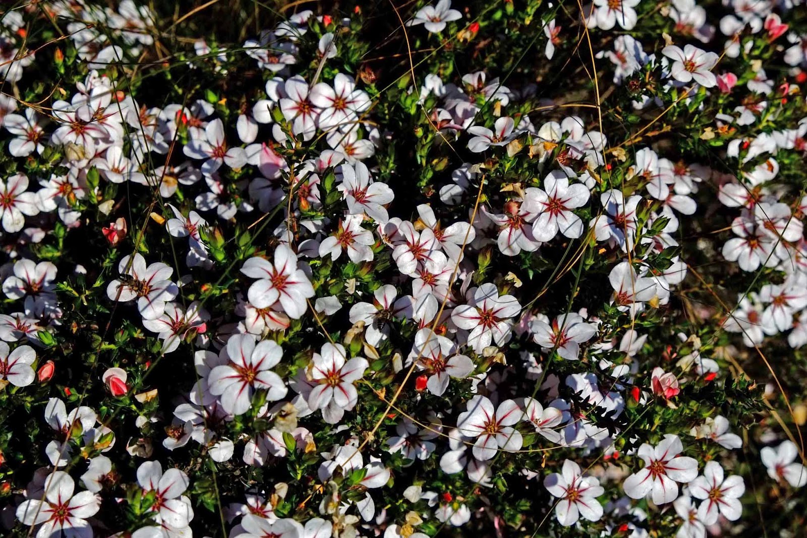
 There is a view point on the highway approaching the park from where one gets a magnificent preview of the wildlife one is about to experience. From here one sees an enormous expanse of wetland with myriad birds and varieties of animals peacefully coexisting; we saw rhino, wild buffalo, a variety of deer and even a fox all at the same time, quite a Garden of Eden image.  The park is largely a wetland plain mainly covered by dense and tall elephant grass interspersed with stands of tropical semi-evergreen and deciduous forests. The picturesque swamplands have a thick cover of water lilies, water hyacinth and lotus.
Water buffalo
Water Buffalo enjoy the swamp
To get a good feel of Kaziranga, I recommend a trip of one day at least, this should include an elephant ride (organised by the wildlife department) and a jeep safari (run privately by the hotels but with a park ranger accompanying). Carry binoculars and a camera with a decent zoom to enjoy the wildlife sightings which are mostly at a distance.
lephant ride through the swamp
Elephant safari
Our early morning elephant ride started at about 6 am and lasted an hour and a half, I suppose these times would vary at different times of the year and might be worth a check before going. This ride takes you through some of the wetlands and swampy area of the Park that are inaccessible to vehicles. About 10 to 12 elephants with four to six visitors on each spread out in a selected area.  The elephant ride is an experience in itself as for most of the time the elephants have to push through the dense and razor sharp grass which is taller than elephant and riders combined.  In the swampy parts these well trained pachyderms seem to enjoy sloshing knee deep through the water and mud.  The wildlife sightings are mainly by the clearings next to the water pools, and one never knows what the next clearing might bring.  Apart from the ubiquitous birds we saw wild buffalo, rhino and a variety of deer; all at a great distance, this is where the binoculars came handy.  As the sun rose we were treated to a spectacular view of the rays of the sun peeping through the clouds and backlighting the hills to our south. Trying to take photos from a swaying elephant back in low light at extreme zoom is yet another challenge.
crested serpent eagle
Crested Serpent Eagle
Rhino real close
a Rhino crosses our path
A little later in the morning a jeep safari for about two hours took us through dense forest and to two view points. Driving along water, either swamp or river, for most of the time, we saw many deer, wild buffalo, birds and turtles basking in the sun on drift wood.  The view points are elevated towers so located as to give a clear view of the area around; from here we managed a good rhino sighting and lots of different types of wading birds. A superb specimen of a crested serpent eagle had the patience to tolerate us real close in a branch overhead. More birds and many distant rhino, deer and wild buffalo sightings later we were on our way home when a lonely male rhino (looking for his lost lady love?) decided to give us a grand display.  He came on to the road about 5 meters from our vehicle and first threatened us with a mock charge; then deciding that we were not worth the effort of another charge, he persisted in going around our vehicle at nearly touching distance for almost 10 minutes, allowing us an unique up close experience and a great photo-op.
Watching from so close a rich and relatively unspoiled ecosystem makes a visit to Kaziranga is a very satisfying communion with nature.  May be in observing these diverse animals peacefully coexist in this Eden like atmosphere there is a lesson for us humans?


Tuesday, 11 November 2014

Personal Pocket Kit


Here is the kit packed and ready to carry

The stuff I carry in it


Here are two pictures of my Personal Pocket Kit, PPK. Most forums refer to this as a PSK personal survival kit, but that's a bit too dramatic for me. Been carrying this kit in my pocket for all my fresh air activities in and around Mumbai and forests elsewhere.
I try and keep a few essentials (and some not so essential but dramatic) stuff in this tiny 10x6.5 cm peppermint box. On this box I have used ranger bands to fix a Boker Gnome.
Contents:
Small SAK (Swiss Army Knife)
Micro torch
Fire starter flint and Vaseline soaked cotton (dramatic stuff!)
Plastic tube containing 
-needle with dental floss threaded, this is a very versatile combo, as it is very strong, repairs just about anything from clothes to shoes and even skin in an emergency.
-a few fishing hooks and line (more dramatic stuff!)
-small safety pins
Medical
-tabs for loose motion, body ache and disprin. Small tube of antiseptic cream and loads of Bandaids. We are playing with sharp edged weapons aren't we?
About 6 feet of very strong and light cord
Large safety pin

All this is packed very compact and in my pocket always when out birding or trekking. Any suggestions?
I have a larger pack which I carry in my backpack, this has more stuff, will post in the future.

Saturday, 11 October 2014

Trek to Lohgarh Fort


Brig (retd.) Xerxes P Adrianwalla enjoys visiting the many splendid forts of Maharashtra. The monsoons add their own sense of adventure, mystery and romance to his tryst with history.
Lohadgarh fort near LonavalaLohagarh, as the name suggests is an iron fort, soaked in history. The bastion stands aggressively amidst the Sahyadris near Lonavala. In the monsoon the fort is veiled in mist, brilliant green foliage lines the route and waterfalls punctuate the verdant hill sides; making a trek to the fort at this time a wonderful experience.
The trek starts at Malavali railway station, when coming here by train; and Bhaje Village if arriving by road. The climb begins at Bhaje, the route being a rubble track to a plateau at the base of, and between the twin forts of Lohagarh � Visapur. To get here takes about an hour of easy climbing. At this point one needs to decide which fort to climb to. Lohagarh being better preserved, the easier climb is recommended.


Lohagarh fort underground roomsAnother small village, Lohadwadi, is situated in the depression between Lohagarh and Visapur, this is really a collection of vendors selling food and drink at the base of the fort. The climb up the steps is easy, with spectacular panoramic views along the way. The fort walls are in good repair and it is easy to discern the three layers of defenses marked by walls. The precision workmanship and fine finish of the stone blocks used in the fort walls are noteworthy, fitted together without cement or any other discernible adhesive. The steps are mostly in good shape, however at places they have eroded due to rain water and small water streams, and it is wise to be cautious at these places as the surfaces are slick with moss. Vichhu Kata. At the top there is not much by way of fortifications but the expanse is large and over interesting undulating terrain. The functionality of the walls and the absence of architectural embellishments within the fort perimeter indicates that these were austere fighting bastions and not fort-palaces as is common elsewhere in the country. The many ancient underground cisterns and the stepped bawdi (tank) used for water storage shows the meticulous planning of the ancient warriors to ensure they did not run out of water during a siege.


Lohagarh fort underground roomsA walk around the top shows a few ancient temples and dargas in varying states of repair and the breathtaking views in all directions. The vivid green panoramas of the rain soaked Sahyadris are truly beautiful. A walk to the Vinchu - Kata (scorpion's sting), so called because of its shape, rewards one with a grandstand view of Visagarh opposite. The Vinchu - Kata was an extension of the fort which was used as a look out, and as a line of defense in ancient days. During the monsoons due to the narrow, slippery path and strong winds, care is advised. During the rains there is a constant mist and fine drizzle at the top and one has to wait for gaps to enjoy the scenic beauty. While descending from the fort the slippery rocks can be tricky.Within a kilometer of Lohadgarh the climb to the twin fort of Visagarh begins. The history of these forts is intriguingly interlinked as they constantly changed hands and one fort acted as the counter to the other. The climb to Visagarh is more arduous and tricky, but more about it in another article.


Koraigarh fort entranceIn the vicinity of the base village are the famous Bhaje Leni (caves), these are reached by a short climb up steps from Bhaje Village. The well preserved carving of these ancient Buddhist caves into the rock face of the mountain framed in waterfalls is definitely worth a visit.If one is energetic and fit it is possible to take in both the forts and the Bhaje Leni in a day, but for the less physically inclined, a walk up to Lohagad and a side track up to the caves would make for a lovely day out in the rains.