Wednesday, 12 November 2014

A Journey to West Kameng District

It is here that the beautiful mountains have witnessed the most humiliating military debacle inflicted on modern India; the drive is redolent with the valiant deeds of long fallen heroes, now enshrined in the many memorials big and small.  Do spend a silent moment at these memorials and honour those who made the supreme sacrifice in the discharge of their duty. 

Arunachal Pradesh is the state formed from the erstwhile North East Frontier Agency (then commonly referred to as NEFA) and a drive through West Kameng is quite representative of the lives these hardy people of the mountains live.  An inner line permit is required to ener the state, this is best got at Delhi or Guwahati.  Our drive followed the popular route Tezpur – Bhalukpong (the state border) – Tenga – Bomdila – Se La – Jung – Tawang – Bum La and back the same way.  A journey we performed in an easy 10 days, staying for 2 – 3 days at places en route.

The entire journey can be done by bus, but if you do hire a vehicle ensure its mechanical soundness as also the condition of its tyres and tubes; mechanics are few and far in between at the higher reaches, whereas the roads (where you can call them roads) are very rough indeed. We had eight punctures during our drive. Being so far East the sun sets very early so allow for adequate time to get to your destination before dark.  Also be sure of the places you are going to stay in as most of the smaller places have very rudimentary accommodation if at all. A little home work will pay very rich dividends at the tired end of a hard day. Eating places (fooding and lodging being the popular phrase) normally take an hour or more to prepare a meal, so carry food for the day to save time.  At night when eating at a restaurant in any of the small towns, order first then walk around the bazaar.

The journey is a wonderful kaleidoscope of green in all its shades and hues; there are few places in our country where you see so much continuous jungle. Our journey began at Tezpur and up to Bhalukpong, flat riverine plains of Assam with large wetlands, rice fields and different types of palms flashing past our windscreen. The deployment of the Army in ‘road opening’ along the way is harsh testimony to the troubles plaguing this beautiful land.

At Bhalukpong you flash your inner line permit and enter first the hills then mountains of West Kameng. It is about here that your mobile will stop working and if you must, then buy a local SIM card. Six kilometers beyond in a tiny place appropriately called Tippi, is one of the largest orchidariums in the country, a sight to see in season.  Driving beyond, the hillsides are now clad in dense rain forest as far as eye can see. Going higher one crosses a pass which is said to be nearly permanently fogged in, visibility is low and steep valleys beckon! Small memorials by the roadside to drivers of vehicles who long ago went over the edge do little to inspire confidence. Spend the night at Bomdila which would take you 8 – 10 hours to reach.

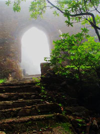
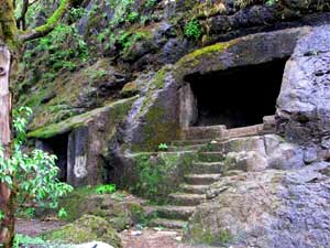
From Bomdila there are many day drives to be done depending on time.  A visit to the new Chhillipam Gompa is truly worth the hours drive through the beautiful Rupa Valley. Recently inaugurated, the detailed craftsmanship of this Gompa is exquisite as is the pride with which one of the young monks takes you around.  Perched on a mountain, the location offers breathtaking views around.

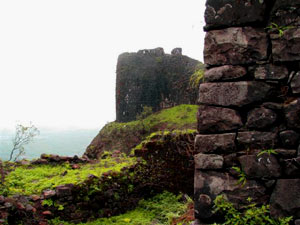
From Bomdila head for Tawang (9500 feet), the route is lined with testimonials to the brave who fought here in 1962. For an old soldier like me, I had to simply stop at each one in a proud salute to brave men who died unsung so far from their homes in the service of the country. The prominent war memorials are located at Jaswantgarh, Nyukmadong and Tawang, these are maintained by the Army and visitors are proudly escorted around.  These memorials are mainly fashioned after the Buddhist Chorten (memorial).  There is a sound and light show at the Tawang Memorial that gives out a brief history of the war.

The scenery from Bomdila to Tawang is ever changing as is the vegetation which ranges from dense rain forest through alpine to the starkness of high altitudes. The Se La (La being pass in Tibetan derived languages) is at an altitude of 13700 feet, It was snow clad on our outward journey. There is a delightfully pretty Tso (mountain lake) just across Se La.  Approaching Tawang one comes to Jung in a valley through which flows the Tawang Chu (river).  Do ask around and find your way off the beaten track to the beautiful Jung Falls (also called Nuranang Falls); this is the site of the Jhong Hydel Project.  These multiple falls have a drop of more than 150 feet into a crystal clear pool below before draining out into the Tawang Chu.


Perched on a hill side, the Tawang monastery (Gaden Namgyal Lhatse Monastery) is reputed to be the second largest in Asia, second only to the Potala palace in Lhasa. This is a major learning centre with about 500 monks, a library and museum.  Due to the recent visit of His Holiness the Dalai Llama, the entire place had been spruced up and was well sign posted.  We were shown around by a very pleasant young monk who had a remarkable breadth of knowledge not only about the monastery and his religion but other subjects as well. One should plan on half a day to visit this serene but awe inspiring place of worship.

Take a day out to go up to Bum La on the border with China, here at the Army post at 15300 feet put a stone on the rock pile of friendship, look across into China and enjoy the spectacular rugged terrain. As you would not be  acclimatised to not exert or spend to long here. The journey is through stark high altitude landscape clad with very colorful moss and shrubs punctuated by very scenic Tso’s in some of the valleys.

This journey into the mountains is a true communion with relatively untouched beauty and the long forgotten heroism of our fallen brethren. Do it slowly, smell the roses along the way, savour and absorb the beauty, the fresh air and the unhurried local ambience.


Meghalaya - a Sojourn in the Clouds

The abode of the clouds, so aptly named.  Do not go to Meghalaya with a plan for a hectic ‘been there done that’ kind of schedule crammed with plans for sight seeing.  This is a state which you have to just soak in ( pun intended); rambling through verdant hills, waterfalls and lakes.  The beauty here is a vivid green kaleidoscope of forested hills, water and clouds.

One can arrive at Guwahati by train or plane and then motor up to Shillong, the capital of the state.  This town used to be the capital of Assam in the old days and the layout and buildings are still redolent of the Raj. Using Shillong as a base one should motor around the state as far afield as one desires.  There is plenty of accommodation in Shillong ranging from the budget friendly to the exotic and expensive.Bungalows in Shillong

The three hour drive up from Guwahati is a precursor of scenes to come, lush green rain forests, and quaint villages with huts that have woven bamboo walls. It is sad though also to see the number of land slides along the way, possibly caused by deforestation. In winter this far East, the sun sets very early, when we went in November by 4.30 pm it was dark, so if you go in the afternoon, much of the beauty is lost in the darkness, to truly enjoy this lovely drive start early.
Don Bosco Museum


Spend a day or two in and around Shillong. There’s the Don Bosco museum and the Butterfly Museum (a privately owned collection),Wards Lake is a nice spot for a stroll. The Police Bazaar is the socially happening place, stroll around and watch a delightfully eclectic fusion of ethnic and west both in music and in dress. Watch the sunset from the Shillong Peak, a view point at the Air Force station, go early as it is a 40 minute drive and there is a crowd to have passes made. Going early also allows time for spectacular panoramic views of Shillong.
Umiam Lake


Spend a day on and around Lake Umiam, 20 kms from Shillong, this vast lake offers a truly serene experience. There is a facility for water sports, but I recommend you find the slowest boat possible and soak in the ambience.  On an island in the lake there is a hotel and house boat, it appears to be the ideal ‘get away from it all’ spot. Many hotels line the shores of the lake, all very scenically located.  We found the Ri Kynjai to be spectacular, both in the views it offered and the entire interiors done in local crafts, primarily cane and bamboo.
Khasi Handicrafts
The hotel buildings have been inspired by the local Khasi architecture. Have lunch here, it is worth every penny of a slightly up market meal. For a bit of culinary adventure, try the Khasi food.


On the way to Sohra

Every one has heard about Cherapunjee, the wettest place on earth; just that we somehow landed up there in its driest month!  Locally known as Sohra, it is a scenic three hour drive to reach there. The terrain and vegetation varies sharply depending on the rainfall patterns.  One passes thickly vegetated hills and valleys as well as starkly barren and flat plains in a seemingly random pattern. Do carry lunch as facilities are few and far between. In Cherapunjee there are many view points from where to see the cloud veiled cliffs which drop sharply down into Bangla Desh. 
On the way to Sohra

The best view is from Thangkharang Park where a walk around the rim of the cliff affords magnificent views. In the rainy months the water falls here would be breathtaking, the dry months are Jan, Feb, Nov and Dec. The limestone formations inside Mawsmai cave merit a visit, though not for the claustrophobic; carry a torch though. 

Green and serenity is the theme of a visit to Meghalaya, enjoy the ambience, flora and calm of one of the least troubled of the North Eastern States.


A Day at Kaziranga

Rhino
The Indian One Horned Rhino
 Kaziranga National Park is synonymous with the great Indian one-horned rhinoceros, the only place in the world where you can see such large numbers of this battle tank like behemoth.  The park is in Assam and covers an area of 430 Sq kms along the river Brahmaputra on the North and the Karbi Anglong hills on the South. The best way to get there would be via Guwahati and Tezpur.  The many places to stay around the park would suit most budgets and levels of luxury. I recommend staying as close to the park as possible to get in an early morning elephant safari.
 There is a view point on the highway approaching the park from where one gets a magnificent preview of the wildlife one is about to experience. From here one sees an enormous expanse of wetland with myriad birds and varieties of animals peacefully coexisting; we saw rhino, wild buffalo, a variety of deer and even a fox all at the same time, quite a Garden of Eden image.  The park is largely a wetland plain mainly covered by dense and tall elephant grass interspersed with stands of tropical semi-evergreen and deciduous forests. The picturesque swamplands have a thick cover of water lilies, water hyacinth and lotus.
Water buffalo
Water Buffalo enjoy the swamp
To get a good feel of Kaziranga, I recommend a trip of one day at least, this should include an elephant ride (organised by the wildlife department) and a jeep safari (run privately by the hotels but with a park ranger accompanying). Carry binoculars and a camera with a decent zoom to enjoy the wildlife sightings which are mostly at a distance.
lephant ride through the swamp
Elephant safari
Our early morning elephant ride started at about 6 am and lasted an hour and a half, I suppose these times would vary at different times of the year and might be worth a check before going. This ride takes you through some of the wetlands and swampy area of the Park that are inaccessible to vehicles. About 10 to 12 elephants with four to six visitors on each spread out in a selected area.  The elephant ride is an experience in itself as for most of the time the elephants have to push through the dense and razor sharp grass which is taller than elephant and riders combined.  In the swampy parts these well trained pachyderms seem to enjoy sloshing knee deep through the water and mud.  The wildlife sightings are mainly by the clearings next to the water pools, and one never knows what the next clearing might bring.  Apart from the ubiquitous birds we saw wild buffalo, rhino and a variety of deer; all at a great distance, this is where the binoculars came handy.  As the sun rose we were treated to a spectacular view of the rays of the sun peeping through the clouds and backlighting the hills to our south. Trying to take photos from a swaying elephant back in low light at extreme zoom is yet another challenge.
crested serpent eagle
Crested Serpent Eagle
Rhino real close
a Rhino crosses our path
A little later in the morning a jeep safari for about two hours took us through dense forest and to two view points. Driving along water, either swamp or river, for most of the time, we saw many deer, wild buffalo, birds and turtles basking in the sun on drift wood.  The view points are elevated towers so located as to give a clear view of the area around; from here we managed a good rhino sighting and lots of different types of wading birds. A superb specimen of a crested serpent eagle had the patience to tolerate us real close in a branch overhead. More birds and many distant rhino, deer and wild buffalo sightings later we were on our way home when a lonely male rhino (looking for his lost lady love?) decided to give us a grand display.  He came on to the road about 5 meters from our vehicle and first threatened us with a mock charge; then deciding that we were not worth the effort of another charge, he persisted in going around our vehicle at nearly touching distance for almost 10 minutes, allowing us an unique up close experience and a great photo-op.
Watching from so close a rich and relatively unspoiled ecosystem makes a visit to Kaziranga is a very satisfying communion with nature.  May be in observing these diverse animals peacefully coexist in this Eden like atmosphere there is a lesson for us humans?


Tuesday, 11 November 2014

Personal Pocket Kit


Here is the kit packed and ready to carry

The stuff I carry in it


Here are two pictures of my Personal Pocket Kit, PPK. Most forums refer to this as a PSK personal survival kit, but that's a bit too dramatic for me. Been carrying this kit in my pocket for all my fresh air activities in and around Mumbai and forests elsewhere.
I try and keep a few essentials (and some not so essential but dramatic) stuff in this tiny 10x6.5 cm peppermint box. On this box I have used ranger bands to fix a Boker Gnome.
Contents:
Small SAK (Swiss Army Knife)
Micro torch
Fire starter flint and Vaseline soaked cotton (dramatic stuff!)
Plastic tube containing 
-needle with dental floss threaded, this is a very versatile combo, as it is very strong, repairs just about anything from clothes to shoes and even skin in an emergency.
-a few fishing hooks and line (more dramatic stuff!)
-small safety pins
Medical
-tabs for loose motion, body ache and disprin. Small tube of antiseptic cream and loads of Bandaids. We are playing with sharp edged weapons aren't we?
About 6 feet of very strong and light cord
Large safety pin

All this is packed very compact and in my pocket always when out birding or trekking. Any suggestions?
I have a larger pack which I carry in my backpack, this has more stuff, will post in the future.

Glimpses of Dharamkot - a photo blog

Blue Whistling Thrush ......
.....greeting a new  day

An iced caterpillar


a juvenile flycatcher contemplates the end of the day
Trapped!
A hungry female beetle trapped in the slime of a slug

Every cloud has a golden lining

a Grey Bushchat female peeks at us coyly......

.....now she gets bolder

a male Grey Bushchat greets the dawn.....

.....looking for an early worm

Reaching out to the sky

....even slugs make out

a Streaked Laughing Thrush flirts among the rocks

A golden end to another day 

Trek To Koraigarh Fort


Brig (retd.) Xerxes P Adrianwalla spends a day in the monsoons driving from Lonavala past the many waterfalls that line the drive to walk up to Koraigarh fort. He recommends it as a perfect family outing.
Koraigarh fortIt looms out of the mist like the prow of the Titanic; enigmatic and majestic, caped in the monsoon green so typical of the region. Koraigarh (or Korigarh), in the vicinity of Lonavala, is a day's nature walk, ideal for the monsoon season when it is a verdant green, swathed in chill mist at the top.
From Lonavala towards Aamby Valley is a 20 km drive past innumerable waterfalls, till one reaches Shahpur (Shivpur) village where you park your car and pay a local shop keeper to look after it. From there it is an hour's easy, but fascinating, walk up the hill.


Koraigarh fort near LonavalaAround the base of the fort there is dense jungle. A path through it takes one to the steps of a fort. This jungle, with dense bamboo thickets, abounds in flora and a fascinating variety of birds and insects. The steps are steep but not very taxing for the average person. At about the halfway mark there are some caves and a view point from where one gets one's first panoramic view of Aamby Valley. There is also a small Ganesh Mandir. Another 15 minutes climb gets one to the top, via an ill-maintained entrance gate to the fort. Like most main entrances to a fort, this is parallel to the walls. The reason for this is to prevent the enemy from being able to gain momentum in a charge to storm the gates.
Koraigarh is particularly devoid of fortifications, very few crenellations, loop holes and other trappings of the more formidable forts in Maharashtra. The fort is not a complex one, it does not appear to have been made to fight a determined enemy. It seems to be either a garrison fort from where distant rulers enforced their writ or a famine relief project. This is apparent from the rudimentary walls which seem only to supplement the natural scarp of the hill. Only at a few places is the fort wall more than just a basic parapet of stone. One such place is, understandably, astride the entrance. Here, there is a tower and more developed defenses. Inside the fort too, the construction is not elaborate. All one can now see are the ruins and the shape of the plinths, but these do not indicate any grand buildings or palaces. This reinforces the idea that being a garrison; the buildings were more utilitarian barracks.
The temple of Korai Devi, after whom the fort is named, appears to have been built much after the fort.
Koraigarh fort entranceInside the perimeter, the walk is a naturalist's delight. The ecology is centered around two ponds that are teeming with life. The most striking is the deafening bull frog chorus: thousands of frogs in curious symphony. The food chain was demonstrated by the presence of a large number of tiny water snakes, land crabs and a multitude of insects.

A walk around the ramparts gives a wonderful panoramic view of the surrounding country, primarily Aamby Valley which lays siege to the fort from nearly three sides.Of course our lesser ecologically minded friends have left a trail of empty bottles and food packets all over in a place seemingly bereft of any garbage clearance system. The best time to visit is early in the morning when one has the place to one's self. Later in the day it can get quite crowded, especially on weekends.
A monsoon walk in the mist and light rain is a truly recommended day out with the family.


Photo Credit: Brig (retd.) Xerxes P Adrianwalla


Tuesday, 4 November 2014

A Trek to Triund and Snowline

The Dhauladhars offer a very different vista compared to the higher ranges in the Himalayas.  Not very high and therefore a wide range of vegetation offers a variety of experiences, views and bird sightings. It is an easy trek that for the young and fit, and can be done in a day, however an overnight stay at Snowline, further on, allows one ‘to smell the roses’ and enjoy the view while walking.
Our trek started from Dharamkot, a laid back hamlet on the outskirts of McLeodganj near Dharamshala. We were staying in a homestay, of which there are many and most don’t appear on the web so you could literally shop around and find a place to stay that suits your budget. Almost every resident who has a house advertises a place to stay, from tiny rooms with common toilets to reasonably well appointed places with en suite rooms.  Prices vary from a few hundred rupees to about Rs1500 per night. Remember this is a hill town and beyond Mcleodganj one has to walk to most homestays.  Therefore the solitude increases in direct proportion to the distance walked.  This imposes caution on the heavy traveller, take what you can carry on your back or you have to hire a porter to take your luggage to the place of stay.

Eating in Dharamkot is superb and cheap. Our very pleasant experiences with Out of The Blue (at the Gallu
Devi road junction)   and Trek and Dine (in the main Dharamkot market) enabled us to eat excellent continental meals at less than Rs 200 per head. Try the pizza at Out of The Blue, it is delicious. The large foreign population is evident everywhere, they are mainly low budget, long stay travellers who have come to this area for its low costs.  Many of the foreigners, are here to learn some skill or the other, hence many signs everywhere on teaching ‘Indian’ skills from yoga through jewellery making to music. The flute seems very popular and we saw a very talented group practising on a roof top one early morning.

Though we had planned a guide and a porter for our trek to the top, the evening prior to our trek, we had met a couple who had come down from the top and they explained the entire route to us.  Based on this we decided to drop the idea of a guide and porter (and save about Rs 5000!). The climb is from an altitude of
approximately 2000 metres at Dharamkot to about 3300 metres at Snowline Cafe.
Initially we thought we would take the direct path from near our homestay in Dharamkot which would meet the Triund track in a much shorter distance, however it was reputed to be very steep and not clearly defined and so much more difficult and time consuming.  Hence we opted for the longer route via Gallu Devi, where the main Triund track starts. We started from our Dharamkot homestay at 7 am and the climb to Gallu Devi took us about 30 minutes.

The track to Triund is a stony, well defined path with steps at places and varying gradient. As we entered the path, a gentleman from abroad, clad in long distance running gear, whizzed past us, presumably running his way to the top! The trek to Triund is an easy three and a half hours or so with spectacular views as we ascend. Due to unseasonal weather in the Dhauladhars, the pattern each day was crystal clear at sunrise, clouds coming in by about 9 am, dense fog/clouds through the day and then again clears by evening and through the night. Due to this by the time we reached the top views were restricted to small vignettes through brief windows in the fog. There were a lot of very pretty flowers blooming and a variety of flora beside the track, we stopped frequently to enjoy and photograph these.


There are three ‘tea stalls’ along the way, these shacks of wood and plastic sell an eclectic mix of water (Rs 40 a bottle as everything comes up by mule); aerated drinks, Maggi noodles, assorted other necessities and non-necessities, and of course tea.  Mid-morning we stopped at Magic View (the better known of the tea stalls) for a cup of over-sweetened tea, this is a great perk up when tired and did wonders for us, even the non-tea drinkers!  From here we admired the view of Dharamkot and the valley which was fast getting
shrouded in clouds rolling in.  We also chatted with fellow trekkers who were going up or coming down; one gains a lot of information in such passing but interesting conversation. By now we began to meet the people who had spent the previous night up at Triund and Snowline and were now descending, they had their own tales to tell.  It was very heartening to see the invasion of the Waste Warriors at these remote tea stalls and the care that the locals take in keeping garbage organised, separate sacks for different types of garbage.  We reached Triund at lunch time amid dense fog, Triund is the junction of three ridgelines and a popular destination judging from the large number of huts, and tents we saw.  At one of the stalls we ordered a meal, this, as we had begun to discover, was either the ubiquitous Maggi noodles or bread and omelette; hungry as we were, we orderedboth. The dense fog precluded any views of the Kangra Valley which is supposed to be visible from here.
After lunch it was time to move on to Snowline.  The track now became less defined; this coupled with the dense fog caused us to lose our way, meandering along false goat trails into a maze of boulders.  The barking of sheep herders dogs, led us to a shepherd’s refuge amongst the rocks, a pen surrounded on three sides by rocks and the fourth side being fenced in with tree branches.  The sheep and their master were away, but I decided that if we had to,
we’d spend the night here rather than on a bare mountain side.  Marking the spot carefully, we moved cautiously towards where we thought the track was, which we found in about half an hour, to our immense
relief.  In a while we discovered a series of yellow arrows marked on rocks, a trail made by the owner of the Snowline Café. Beyond Triund it is important to follow these arrows as the trail is not very clear and it is easy to get lost, particularly in fog. As we were continuously gaining altitude, the hill side got barer, with pine trees and rhododendrons being more evident.
We reached Snowline at 4 pm, a little late due to our wandering off the track earlier. The name comes from the fact that pre-global warming; this was the point from where the permanent snowline started.  However now it has receded substantially and there is no sign of snow except on distant peaks.  Even   the glacier is now a muddy tract of ice on a distant hillside. We were ravenous when we reached and immediately requested the owner to make us; yes you guessed it, a plate of hot Maggi noodles and sweet tea.
Snowline Café….a grand name for a plastic sheet and wood shack, the only one here, has been here for more than 18 years (so says the owner) and is the overnight staging point for trekking further to the Lahesh Caves and Indrahar Pass.


Apart from water and other supplies, the owner provides lodging too.  Rs 500 gets you your own six feet of space to spread your sleeping bag or his three blankets, a little more money upgrades you to a one or two person tent and a sleeping bag. His intense marketing, signs painted on rocks, proclaims this to be the last café on this route. Others at the café were a couple, a French boy with his Assamese girlfriend staying in the shack, a party of three Russians with their guide using their own tents. Dinner was a simple but tasty rajma-chawal which everyone enjoyed. The owner, colourful gentleman, had interesting stories to tell. When I asked him whether he had heard of Mumbai, he looked disdainfully at me.  He had sold bed sheets bought in Ludhiana on the footpaths of Mumbai and Delhi for a number of years!  He then started Snowline Café.

Being October it was not too cold, the temperature range for the entire trek was between 12 and 22 degrees centigrade. In the morning everything was soaked in a thick layer of dew. The others were moving on to the Indrahar Pass (a 9 hour round trip) and so left at 7 am. We were not prepared for this leg of the trek and so decided to turn back after enjoying the sunrise.  From here to the Indrahar Pass it is advisable to have a guide or move in a self-sufficient group as the route is not defined clearly. There is no place to stay beyond the Snowline Café, though those carrying a good enough sleeping bag and food, have stayed in Lahesh Caves.
We enjoyed the sunrise over the Dhauladhar Range on a sharply clear morning. This is a spectacular light show, as the sun rises from behind the range and the rays gently caress highest peaks first, gradually spreading their warm glow downwards, backlighting the heights in descending turn. We were told that the sunrise in each season is very different and each a joy to behold.  How true, we were truly enthralled.
After a breakfast of more Maggi noodles, we began our descent.  The walk down to Triund took us an hour along an isolated track; lost in our solitude we enjoyed nature at its pristine and untrammelled best. Only serious trekkers come this far, and they are usually careful of their surroundings. A pair of Himalayan Griffon, huge majestic birds, kept us rapt with their precision gliding.  They seem to effortlessly ride the thermals by just moving their wing tips, not one flap of the wings in all the time we were watching; what supreme economy of effort. In the dense forest on the lowers slopes we heard many calls of jungle fowl but nary a sighting.

From Triund walking down was as anti-climatic as the descent in altitude; the tranquillity of the two days was shattered by at least a thousand people who were going up to Triund for the long weekend.  This was a veritable parade of fashion, selfies, blaring music and suitcases on mules.  A raucous welcome back to reality, The Great Indian Traveller strikes again!